Trails: Polecat (Wildcat Ski Area) and Wildcat Ridge
Total Distance: 9.2 miles Vertical Gain: 3900'
So here's how we managed to hike the Wildcats on this particular day. Jack, who's become our de facto 3rd Musketeer, is on the phone with me Friday afternoon. He says he's hiking tomorrow, maybe with a friend, to do something that we haven't done. (We're trying to sync our NH 48s list.) He's thinking of doing the Wildcats. Whoa!! Wait a minute. Thomas and I haven't done those. Oops. He doesn't have the list. It's at home. I basically say he can't do the 'Cats without us. We're going! And that's how we 3 came to all be together on Saturday morning.
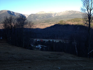
It was a crisp, clear morning in Pinkham Notch. We drove into the Wildcat Ski Area parking lot and geared up.We had decided to ascend 'D' peak, which is by the top of the ski area, via the Polecat ski trail. Started out about 8 am, with the sun tucked behind the mountain. It was lighting up the other side of the notch, though. We're just above the base lodge.
A little farther up the ski trail.
We had some great views going up 2.5 miles on Polecat, winding our way on the north side of the ski area to the top of the highest lift. Did not take many pics. It was a steady climb, and arrived on top at 10 am.
Looking west at Mt. Washington.
And off the backside facing southeast.
Thomas enjoying the morning sun and view.
This is where we connect with the Wildcat Ridge Trail, which crosses all the peaks (A through E) of Wildcat Mountain. From here, it's roughly 100 yards or so up to the summit of 'D' Peak.
Recently, the observation deck was rebuilt. It stands directly over the high point. Thomas checking it out.
Jack, figuring out how to tackle the summit 4' to his right.
Time for a snack break! Thomas chooses a window seat.
Jack wants in on the cheese and trail mix.
Another one down. As we're having our break, a group of 6 guys rolls through doing a point to point hike. We chat for a bit, then off they go, never to be seen again.
Break over, we hit the ridge trail about 10:30 am. It's 2 miles of ups and downs to 'A' Peak. Between C and B, The remnants of a blowdown, probably from Irene last fall.
Story time. Thomas has been growing so fast, he outgrew his hiking boots. Thought today might be a little cold for sneakers. So I give him my old hiking boots, that fit him, but had not been used for a few years. On the ridge between peaks, the right sole starts to separate from the boot at the toe. No problem. A little duct tape is all you need.
Issue solved for now.
More on that later. We know we're close to the top. There's a sign on a tree pointing to a view spot. Heading down the side trail, it ends at a rock outcropping. What a view!!
Looking at Carter Dome and into Carter Notch, with its hut and pond.
Sweeping north from R-L are Carter Dome, Mt. Hight, and South & Middle Carter.
Somebody's happy.
One problem. Where's the summit? We hadn't passed a cairn on the trail, had we? Kept on the trail for a bit. BUT, in no time the trail starts to head down into Carter Notch. We back up, past the viewpoint, and start descending again. Turn around again. There's another side trail that leads to a clearing/ campsite. But no marker. As we return to the main trail again, I see a 12" wide slash through the trees.
Follow it in 20' or so. Lo and behold, on a moss covered rock, is the summit cairn.
#31 in the books!
"Hey Thomas. Let us squeeze in there for a pic."
Gotta get one together!
You can't always assume the trails go over the summits. Sometimes, you're searching.
Having gotten our 2 peaks today by noon, we break for lunch on a sunny rock slab out of the cool breeze, then retrace our steps back to 'D' Peak. Meanwhile, both of Thomas's boot soles are starting to let go. There were a few sketchy sections of ice on the ridge between peaks, and the boot situation did not make it any easier. He remained a trooper, flopping along carefully.
Back at 'D' Peak, Jack and Thomas go for the true summit pic.
From the top of the ski area, looking at Mt. Washington. Notice how the shadows are already hiding features of the mountain.
Mts. Adams, center, and Madison, to its right.
It's 2:15 pm as we start down. Already the sun is hiding behind ridges, and temps are cooling in the shade. Halfway down, both boot soles have had enough. Thomas gives me the look, and I know. We yank them off the rest of the way. Thomas is happy. He says the boots feel softer on his feet. I wonder why?
This is a fitting last photo to the hike. Still smiling.
Back at the car at 3:30 pm, for a total hike time of 7.5 hours. Est. 1.5 hours of resting - eating - view gawking time. The mileage today wasn't huge, but there was a good amount of vertical gain. I can't believe how lucky we've been weather-wise with our hikes. You can't plan or count on weekends like this mid-November. They just happen, and we're glad we could take advantage of it.
Thanks to Jack, for guilting us into coming along. ;-) Payback's coming.
So, 31 down, and 17 to go. Woo-Hoo!!
'Til next time.....
(( *
* ))
(( *
* ))


