Total Distance: 12.0 miles Vertical Gain: 4300'
I took a little bit before writing this trip report. Wanted to let it sink in with some reflection time.
After all, we had just travelled over 3 of the 5 highest peaks in the White Mtns.
Along with Thomas and me, our bespeckled friend Ted Wallace agreed to hike with us and bring his car, which made this whole 1-way hike possible. Also, another friend, Don Studley, he of the gray moustache, came along with his 2 sons, Kevin and Ryan. 6 of us total. It's on !!
We got an early start to the trailhead in Jefferson Notch. Started up the Caps Ridge trail right at 7am.
Just on trail are me, Kevin, Ted, Thomas, Ryan, and Don.

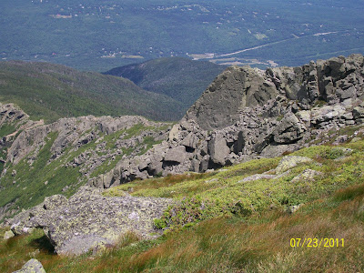
It was cloudy, cool, and drizzling off and on driving over and starting up the trail. Perfect weather to gain over half of our vertical right away, considering the valleys were forecasted for 90 degrees plus and high humidity. 1 mile in, we come out on a ledge, giving us views of the 3 Caps and the summit of Jefferson.

Once we get to the Caps, some serious scrambling over damp rocks. Smile, boys.

As we gain altitude, more tremendous views present themselves. Looking south towards Monroe, Eisenhower, and Pierce. The southern Presidentials.

Ted, me, Thomas, and Don below Jefferson's false summit. Quite the rockpile.

And the junction with The Cornice.

At this junction, we managed to lose the Caps Ridge trail, and wound up on The Cornice, adding a 1/2 mile to the day. We finally gain the ridge, and the Gulfside Trail, with the cloud cover rising, and the wind howling.
Thomas, with Mt. Washington and the Great Gulf behind him. Hair just'a'blowin'!

Time for a quick snack and break. Jefferson's summit behind us on the left.

When we were heading up Caps Ridge, Thomas and I ran into someone we had met just a few months ago while doing Moosilauke. Ed, and his dog, "Lauke" from the hiking blog site "Views From The Top". Ed'n'Lauke on top of Jefferson.

Our summit photo.

Thought this plaque on top of Jefferson was a very cool thing to do for a friend who was missed. Hopefully you can zoom this to read the inscription.

Made the summit at 9:30am. Ryan and Kevin on top.

About this time, the clouds started lifting with patches of blue and spotty sunshine. Some days are just special.
Heading down to Edmunds Col with Adams, our next objective, looming in the background.

The steep walls of Jefferson Ravine are more striking the closer you get to them.

We were coming across quite a few hikers on the upper alpine zone. A couple heading towards us.

As the skies continued to clear, and the winds picked up even more, we noticed these Lenticular clouds stacking in the upper atmosphere.

Kevin and Don having a father / son moment 1 mile up. Seemed no matter where we were taking a pic, Mt. Adams kept showing up in them.

We finally hook up with Lowe's Path.

Time to scramble up some serious chunks of rock to the top.

Ted and Thomas on Adams, with Jefferson behind.

#16 in the books at 11:30am. Our summit pic, with the Great Gulf wrapping around Thomas.

From Adams' summit, we head down the Airline and once again hook up w/ the Gulfside Trail.
Very cool rock formations on the way down towards Madison Hut.
We were all getting hungry, and decided the "hut" would be our lunch spot. Here it comes into view, with Madison waiting beyond, later.

Thomas leading the way down.

Arrived at Madison Hut around 12:30. This hut just re-opened this past June. Very nice job of it. They had a kitchen inside cooking away, and all the drinkable water you want. We ate our own food, but a couple of us sampled these massive-caloried chocolate chip brownie squares. Should've got a pic of those.

Looking back at Adams.

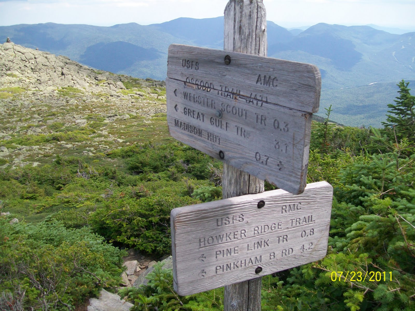
Time to start the final descent towards Howker Ridge on the Osgood trail.

Just below the summit, we got into some more funky rock formations. Kevin, a Colorado guy now, showing us some fine bouldering techniques.

Reaching the junction w/ the Howker Ridge trail. Only 4.2 miles to freedom.

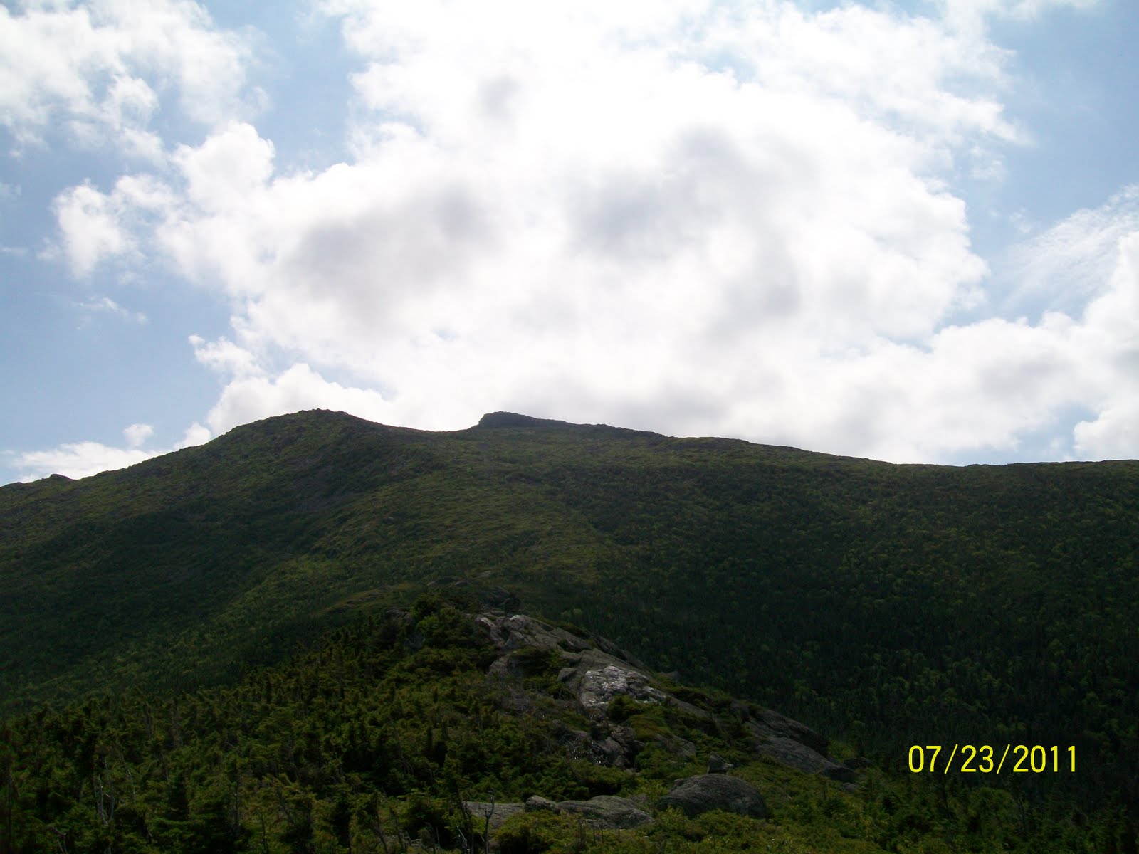
Partway down Howker Ridge, looking back up at Madison.

You could tell there's not a ton of foot traffic on this trail. It was suggested by a friend as an alternative with plenty of views up high while descending. A couple of the Howks waiting for us to hike over them. There were 3 or 4 of these knobs we negotiated on the way down.

A final view NW towards the Pliny Range, with Mts. Waumbek and Cabot in the distance. Thomas and I will be attacking those later.


We dropped into the trees and went without views for the final 2.5 miles or so. We did come across some beautiful waterfalls and gorges, and the last mile was relatively flat.

We all felt great knowing what we had hiked. 12 miles is a good distance. But the big nut wasn't the 4300' vert up; it was the 6300' vert of down!! Whoa!! About 10.5 hours total hike time.

We were all getting hungry, and decided the "hut" would be our lunch spot. Here it comes into view, with Madison waiting beyond, later.

Thomas leading the way down.

Arrived at Madison Hut around 12:30. This hut just re-opened this past June. Very nice job of it. They had a kitchen inside cooking away, and all the drinkable water you want. We ate our own food, but a couple of us sampled these massive-caloried chocolate chip brownie squares. Should've got a pic of those.
It was such a relaxing 1/2 hour break, I didn't take 1 pic of inside the hut. I will amend and add a photo later if someone else got any.
Leaving the lodge was an exercise just getting the legs moving again. Basically 550' of vert straight up the rocks. Again! We hit the top in a raging wind at 1:30pm.
Here's Keith, Mick, Woodie, and Charlie atop Madison.
Ladies and gentlemen, The Rolling Stones! (Struck me as looking like a band photo!?!)
Top of the world, Ma!
Top of the world, Ma!

Looking back at Adams.

Time to start the final descent towards Howker Ridge on the Osgood trail.

Just below the summit, we got into some more funky rock formations. Kevin, a Colorado guy now, showing us some fine bouldering techniques.

Reaching the junction w/ the Howker Ridge trail. Only 4.2 miles to freedom.
Partway down Howker Ridge, looking back up at Madison.
You could tell there's not a ton of foot traffic on this trail. It was suggested by a friend as an alternative with plenty of views up high while descending. A couple of the Howks waiting for us to hike over them. There were 3 or 4 of these knobs we negotiated on the way down.

A final view NW towards the Pliny Range, with Mts. Waumbek and Cabot in the distance. Thomas and I will be attacking those later.

And 1 final look up at Madison.

We dropped into the trees and went without views for the final 2.5 miles or so. We did come across some beautiful waterfalls and gorges, and the last mile was relatively flat.
All down safe and sound. Still smiling, although I personally had some sore and painful knees coming down from Madison.
Once again, the gang: Me, Don, Thomas, Ryan, Ted, and Kevin.

We all felt great knowing what we had hiked. 12 miles is a good distance. But the big nut wasn't the 4300' vert up; it was the 6300' vert of down!! Whoa!! About 10.5 hours total hike time.
Once again, a big thank you to Ted, whom without this pt. to pt. hike would not have been possible.
And to Don, Ryan, and Kevin. Thanks for tagging along and making this an event that was not to be missed.
Thomas just keeps getting stronger as we hike the 48s. I keep saying it; I'm proud of him.
We haven't done a big hike like this w/ that many people, and the camraderie and spirit were shared by all. So thank you all.
One last honorable mention has to go to the weather. Although windy most of the day (expected up high), what was a very hot day in the valleys was a beautiful, comfortable day in the mountains. Cool on our initial climb to ridgeline, then the sun came out and made this day one of the best in the mountains. Sometimes fate smiles upon you.
17 down - 31 to go.
'Til next time.................................
((*
*))
((*
*))


Nice trip report Paul. What a great route for picking off the three northern Presi's. Congrats! TrailsNH has been mapping your progress at: http://trailsnh.com/?source=PTH&age=24
ReplyDelete-Kimball