Monday, November 19, 2012

Wildcat 'D' (#30) & Wildcat Mtn ('A' Peak) (#31) November 17, 2012

Trails: Polecat (Wildcat Ski Area) and Wildcat Ridge

Total Distance:  9.2 miles                 Vertical Gain:  3900'

So here's how we managed to hike the Wildcats on this particular day. Jack, who's become our de facto 3rd Musketeer, is on the phone with me Friday afternoon. He says he's hiking tomorrow, maybe with a friend, to do something that we haven't done. (We're trying to sync our NH 48s list.) He's thinking of doing the Wildcats. Whoa!! Wait a minute. Thomas and I haven't done those. Oops. He doesn't have the list. It's at home. I basically say he can't do the 'Cats without us. We're going! And that's how we 3 came to all be together on Saturday morning.

It was a crisp, clear morning in Pinkham Notch. We drove into the Wildcat Ski Area parking lot and geared up.We had decided to ascend 'D' peak, which is by the top of the ski area, via the Polecat ski trail. Started out about 8 am, with the sun tucked behind the mountain. It was lighting up the other side of the notch, though. We're just above the base lodge.


A little farther up the ski trail. 


We had some great views going up 2.5 miles on Polecat, winding our way on the north side of the ski area to the top of the highest lift. Did not take many pics. It was a steady climb, and arrived on top at 10 am.


Looking west at Mt. Washington.


And off the backside facing southeast.


Thomas enjoying the morning sun and view.


This is where we connect with the Wildcat Ridge Trail, which crosses all the peaks (A through E) of Wildcat Mountain. From here, it's roughly 100 yards or so up to the summit of 'D' Peak.


Recently, the observation deck was rebuilt. It stands directly over the high point. Thomas checking it out.


Jack, figuring out how to tackle the summit 4' to his right.


Time for a snack break! Thomas chooses a window seat.


Jack wants in on the cheese and trail mix.


Another one down. As we're having our break, a group of 6 guys rolls through doing a point to point hike. We chat for a bit, then off they go, never to be seen again.
Break over, we hit the ridge trail about 10:30 am. It's 2 miles of ups and downs to 'A' Peak. Between C and B, The remnants of a blowdown, probably from Irene last fall.


Story time. Thomas has been growing so fast, he outgrew his hiking boots. Thought today might be a little cold for sneakers. So I give him my old hiking boots, that fit him, but had not been used for a few years. On the ridge between peaks, the right sole starts to separate from the boot at the toe. No problem. A little duct tape is all you need.


Issue solved for now.


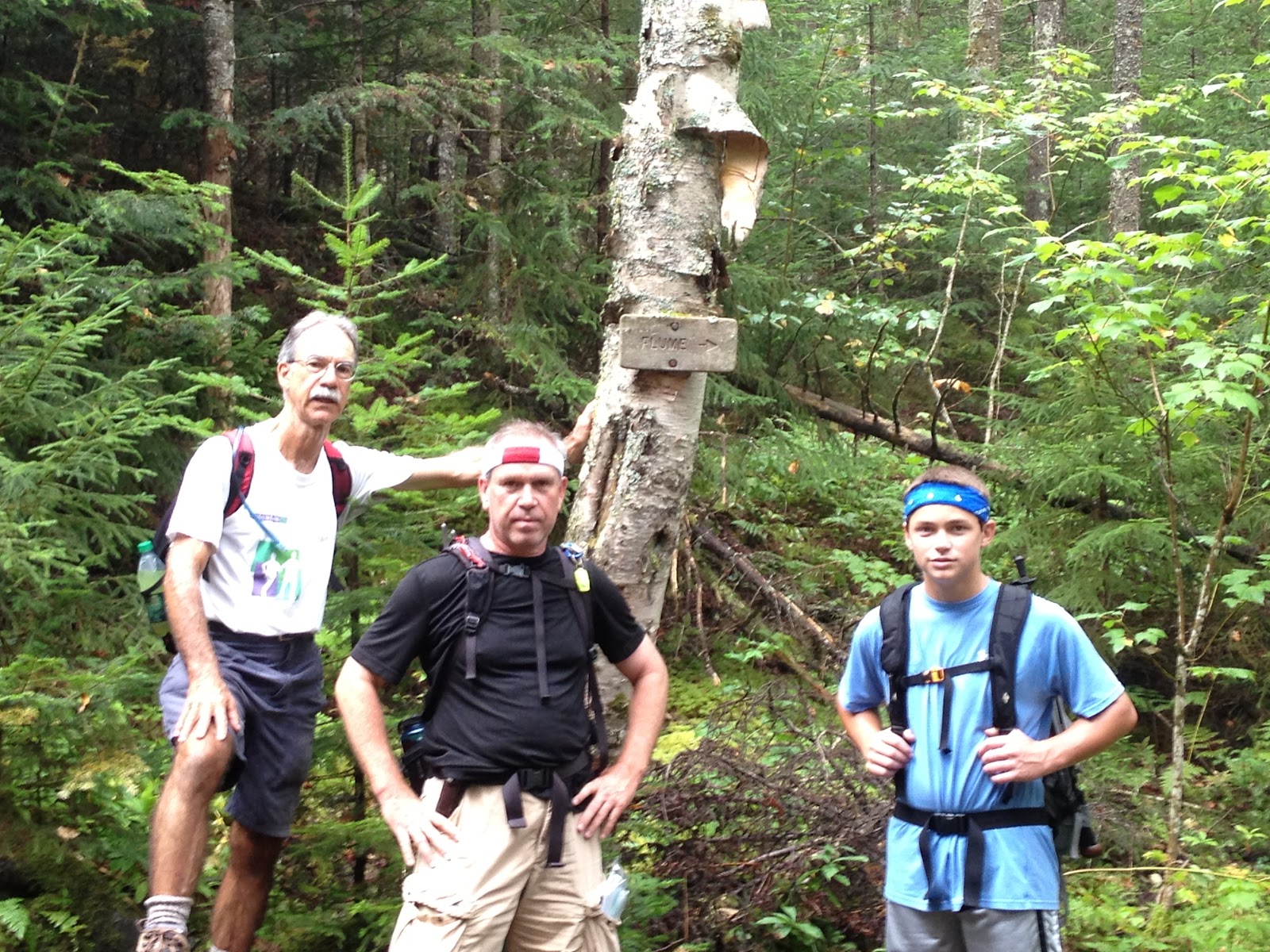
More on that later. We know we're close to the top. There's a sign on a tree pointing to a view spot. Heading down the side trail, it ends at a rock outcropping. What a view!!

Looking at Carter Dome and into Carter Notch, with its hut and pond.


Sweeping north from R-L are Carter Dome, Mt. Hight, and South & Middle Carter.


Somebody's happy.


One problem. Where's the summit? We hadn't passed a cairn on the trail, had we? Kept on the trail for a bit.  BUT, in no time the trail starts to head down into Carter Notch. We back up, past the viewpoint, and start descending again. Turn around again. There's another side trail that leads to a clearing/ campsite. But no marker. As we return to the main trail again, I see a 12" wide slash through the trees.


Follow it in 20' or so. Lo and behold, on a moss covered rock, is the summit cairn.


#31 in the books!


"Hey Thomas. Let us squeeze in there for a pic."


Gotta get one together!


You can't always assume the trails go over the summits. Sometimes, you're searching.

Having gotten our 2 peaks today by noon, we break for lunch on a sunny rock slab out of the cool breeze, then retrace our steps back to 'D' Peak. Meanwhile, both of Thomas's boot soles are starting to let go. There were a few sketchy sections of ice on the ridge between peaks, and the boot situation did not make it any easier. He remained a trooper, flopping along carefully.

Back at 'D' Peak, Jack and Thomas go for the true summit pic.


From the top of the ski area, looking at Mt. Washington. Notice how the shadows are already hiding features of the mountain.


Mts. Adams, center, and Madison, to its right.


It's 2:15 pm as we start down. Already the sun is hiding behind ridges, and temps are cooling in the shade. Halfway down, both boot soles have had enough. Thomas gives me the look, and I know. We yank them off the rest of the way. Thomas is happy. He says the boots feel softer on his feet. I wonder why? 

This is a fitting last photo to the hike. Still smiling.


Back at the car at 3:30 pm, for a total hike time of 7.5 hours. Est. 1.5 hours of resting - eating - view gawking time. The mileage today wasn't huge, but there was a good amount of vertical gain. I can't believe how lucky we've been weather-wise with our hikes. You can't plan or count on weekends like this mid-November. They just happen, and we're glad we could take advantage of it.

Thanks to Jack, for guilting us into coming along. ;-)    Payback's coming.

So, 31 down, and 17 to go. Woo-Hoo!!

'Til next time.....

(( *

* ))

(( *

* ))


Monday, September 10, 2012

North Kinsman (#28) & South Kinsman (#29) September 1, 2012


Trails:  Mt. Kinsman, Bald Peak Spur, Kinsman Ridge, and Reel Brook trails

Total Distance:  11.9 miles                    Vertical gain:  4,000'

Could it be? 2 hikes on consecutive Saturdays? Pinch me. Seeing how we didn't hike a 4Ker all summer, this kinda catches us right up. On the drive over, a setting moon to go with a rising sun.


Once again, we have friends joining us for a 7:45 am start time. Jack, Don, and Thomas at the Mt. Kinsman trailhead.


We started our hike on the west side of the Kinsmans, which means more shade and cool for a while. Just 15 minutes in, a beam of light peeks through the forest. Jack spotted this.


A quick break on the trail.


Halfway up the Mt. Kinsman trail, we cross Flume Brook. A side trail leads down 150 yards or so to the flume.


These pics don't do it justice, but it was quite a drop through a big crack in the rocks. Probably 30-40 ft.


Back we go to the main trail, where 100' up, another side trail leads to Bald Peak. This rocky spur is the high point of a shoulder off the west side of North Kinsman, and a nice spot for a break.


Our old friend Moosilauke, (we've been there!) standing above the clouds.


We didn't have a view of our objectives today from Bald Peak. It was too cloudy and misty. So after a our break, it's back to work on the trail. We finally gain the ridge and the junction with the Kinsman Ridge trail.


Just a short way to our 1st summit. No cairns or markers on top. Thomas on the highest point we can find at 11:15 am. Can you see him?


Just past this point is is a little shootoff to a ledge facing east.


We pull off the packs to take a break. 1 minute later, the clouds start lifting like a curtain going up. The show is about to start, giving us unbelievable views of Cannon Mtn. and Franconia Ridge.


Mts. Lincoln and Lafayette, with Lonesome Lake in the foreground. A closer look.


The gang, feeling pretty special right now.


Well-rested, we backtrack 50' to the high point for the old guys summit shot.


Father & Son on #28. Yeah!


It's almost a mile between the 2 tops, so down we go, and up we go. Looking back at North Kinsman through the trees.


Just shy of our next peak. Amazing how bluebird the sky has become. Jack's liking it.


Thomas conquering South Kinsman.


Once again, the gray crew hiking buds.


#29 in the books for us!


Franconia Ridge from South Kinsman.


The southern peaks of the ridge on the right, Mts. Liberty and Flume


Looking west, the farthest peaks in the distance are in Vermont.


Can't get enough of this view.  :-)


We arrived on top around 12:30pm. Time for lunch. While we were eating and relaxing, we could hear a plane in the distance. It was hauling up gliders to play in the wind. 3 different gliders were flying around, riding the thermals as quiet as birds. It was pretty cool watching them go over us!


 Once we packed up, a hiker took a group shot for us.


Now comes our big decision. Do we go back the way we came, OR, continue south over less traveled trails and longer mileage? Let's do a loop hike, of course! We had spotted a car, might as well use it.

Looking south to the massive hulk of Moosilauke, now out of the clouds.


And into the southern end of Franconia Notch. We didn't know it heading down, but we'll be very close to those ponds in the distance.


We knew the 1st mile or so down was going to be steep. And it did not disappoint. Here's Don, making his way down one of the many slab and boulder fields.


I didn't take too many pics on the steeps, but we finally came out to tiny Harrington Pond.


Looking up at some of the cliffs and rock all the way up to South Kinsman.


At this point, still on the Kinsman Ridge trail, we enter the woods and follow Eliza Brook. We were in awe with how beautiful this brook and trail was. So many picturesque little falls, slides, and drops. Here are a few.


We cross Eliza Brook for the last time, and take a break by the Eliza Brook shelter, a nice lean-to and tent site.


It's 1 mile to the Reel Brook trail, our way out. More scenery on the way.


You can just see those ponds behind us. The ones we saw from the top of South Kinsman.
We're tired, but happy.  --  I think.


Ahhh, our Yellow Brick Road.


 We put our heads down and go. With barely a break or stop for pics, we all want out of these woods. Come out at the trailhead around 5:15 pm. My big faux-pas? No picture of us on the exit. Sorry. But as we drive back to our starting point , our day appears before us. North and South Kinsman, as seen from NH 116. We couldn't see them this morning.


Wow! Big day! On the trip over this morning, we encountered a smallish black bear that crossed the road right in front of us. We stopped, and it jumped the guardrail 15 ft. away.Too interested in watching to think about taking a picture. Wish I would have now. Oh, well.

Back to the hike. Did I say big day? Did not realize until after the hike when I tallied the totals. 4,000' vertical gain. Whew. 9-1/2 hours total hike time. A great effort by all.

Thanks again to Jack and Don for joining us. I don't know if it's because we hadn't hiked in a while, but the views up high today were some of the best we'd ever seen. Glad we could share it with friends.

Thomas is getting stronger and stronger hiking-wise. Nothing he does surprises me anymore. Way to go!

We have now done...............29!!!!!   Only 19 more. Kinda bittersweet.  But can't wait.

'Til next time...........


(( *

* ))

(( *

* ))